|
Panama Canal
|
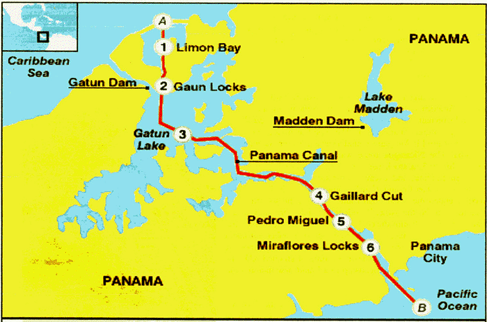
The map below highlights the major portions of the canal. We transited from the Pacific to the Atlantic (B to A), a distance of fifty miles. The total elevation change is 85 feet. There are a total of three lock clusters ( 2, 4 & 5). We entered the Miraflores Locks first, which consisted of two "steps". The third lock several miles further, took us up another step to the level of Gatun Lake. This lock is call the Pedro Miguel lock. The lake is massive covering 163 square miles. We were told that it took 3 years for the lake to fill up. The most amazing thing about the canal is that the entire operation is run by gravity. No pumps what so ever are used. We were told that approximately fifty one million gallons of water are "used" for each ships passing through the canal. This is not wasted water as the water would have flowed into the ocean in any case.
Navigate by clicking on a point of interest on the map below or using one of drop-down menu items above.