Pula, Croatia
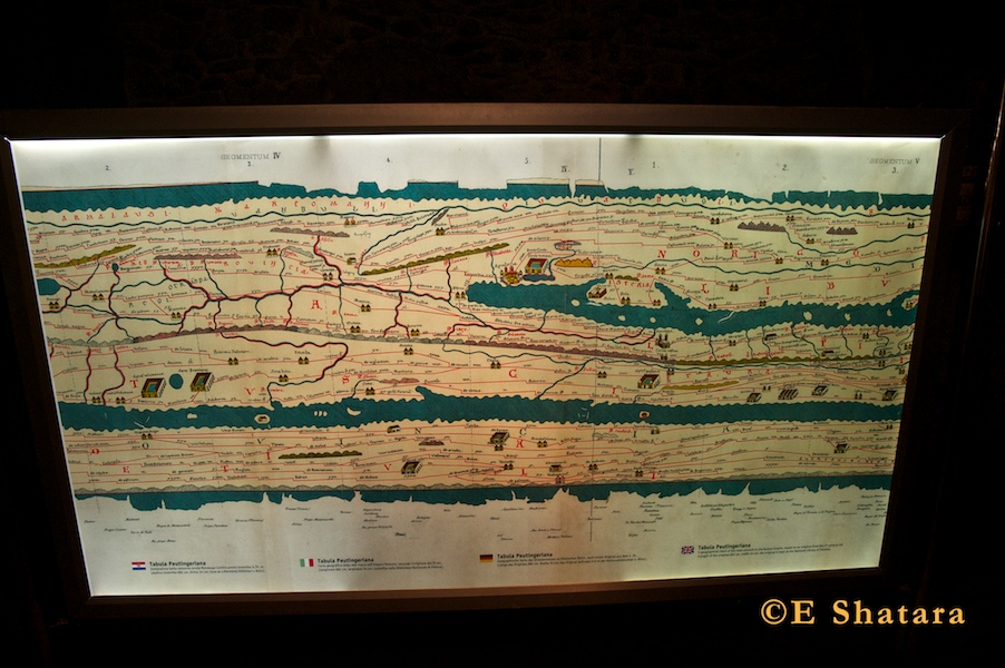
A geographical chart of the road network in the Roman Empire in the 4th century AD. Istria can be seen as the triangular shaped peninsula jutting into the body of water in the middle of this photo.
© E. Shatara, 2011